Software
Visit my Github repo for various open source projects: www.github.com/dotMorten
Below are various software projects I have available for download
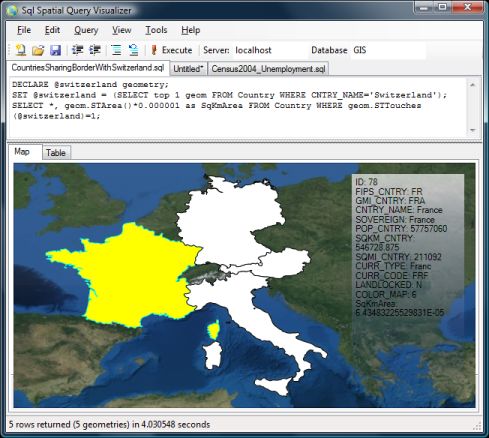
SQL Server 2008 Spatial Tools
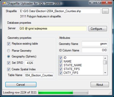
- Shape2Katmai: Uploads ESRI Shapefiles to Microsoft SQL Server Spatial
- SqlSpatial: Queries MSSQL Server 2008 and displays geometry output on a WPF-based interactive map.
Related blogposts:
Download
.NET Raytracer
.NET 2.0 based raytracer library for raytracing triangles in 3D surface model with high precision.
Related blogposts:
Download (86 kb) (includes source)
Shape2PostGreSQL
Uploads ESRI Shapefiles to a PostGreSQL database.
Related blogposts:
Download (644 kb) (includes source)
Triangulator
.NET 2.0 library to triangulate point data using Delauney triangulation.
Related blogposts:
Download (35 kb) (includes source)